

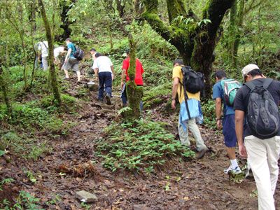
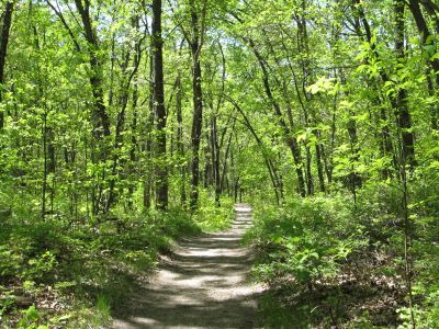
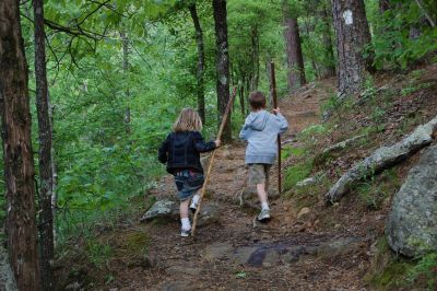
HIKING IN & AROUND Trenton


 Trails Map & Information - TAP HERE
Location of Trails listed below.
TAP HERE
"Information is accurate as we believe but there may be some errors or omissions. Please let us know if you find any."
- Lake Ontario Waterfront Trail: Quinte West's part of the 1,400 km Great Lakes trail. Travel along County Road 64 with a branch along the Murray Canal. At County Road 64 and Hwy 33 the trail heads into Trenton, through downtown, Fraser Park and Centennial Park.
GPS: N 44o 03.344 W 077o 35.858
Offers: Walking/Jogging, Cycling, Cross Country Skiing, Snowshoeing, Horseback Riding
- Hanna Park: Located at the corner of Film St. & Creswell Dr. in Trenton. 42 acre park with tennis courts, playground, picnic area and dog park. There is a 1.9 km nature trail through the woods
GPS: N 44o 05.634 W 077o 35.048
Offers: Hiking, Cycling, Cross Country Skiing, Snowshoeing, Benches
- Trenton Greenblet Conservation Area: Trent-Severn Waterway Lock 1, here follow the Jack Lange Memorial Walkway for 2.5 km on crushed gravel along the shoreline.
GPS: N 44o 06.581 W 077o 35.498
Offers: Walking/Jogging, Cycling, Cross Country Skiing, Benches, Boat Launch, Picnic Shelter
- Lower Trent Trail: A 17 km Rail train with a limestone granular surface. Rest stops and scenic areas makes it great fun for the whole family. Trail can be accessed at Lock Road and Bleasdell Boulder in Glen Miller, Plant St. and Perry Dr. in Batawa, Mill St. in Frankford, and at several road crossings along the trail.
GPS: N 44o 07.735 W 077o 36.204
Offers: Walking/Jogging, Cycling, Cross Country Skiing
- Bleasdell Boulder Conservation Area: This area cotains one of the largest glacial erratics in North America. This 2 million pound boulder is 2,3 billion years old. The area is also home to a wide varietytree, flowers, ferns, birds and wildlife. Located in Glen Miller with a 1.5 km looping trail, with a 6km link to the Lower Trent Trail.
GPS: N 44o 08.805 W 077o 35.100
Offers: Walking/Jogging, Cycling, Cross Country Skiing, Snowshoeing, Benches, Picnic Tables
- Frankford Tourist Park: This area cotains one of the largest glacial erratics in North America. This 2 million pound boulder is 2,3 billion years old. The area is also home to a wide varietytree, flowers, ferns, birds and wildlife. Located in Glen Miller with a 1.5 km looping trail, with a 6km link to the Lower Trent Trail.
GPS: N 44o 12.129 W 077o 35.553
Offers: Walking/Jogging, Roller Blading, Beach, Snowshoeing, Picnic Shelter, Event Site, Washrooms, Camping
- Bata Island: Entrance is opposite Huffman Rd., 1.2 km north of downtown Frankford on North Trent St. This woodland area has trails that loop the island. A meadow in the centre of the island is nce for bird watching.
GPS: N 44o 12.737 W 077o 35.986
Offers: Walking/Jogging, Snowshoeing
- Sager Conservation Area: Located at 30 Golf Course Road, this is a day use area with forest trail that leads to a fantastic lookout tower providing a great place to vie the surrounding countryside.
GPS: N 44o 14.910 W 077o 32.403
Offers: Hiking, Cross Country Skiing, Picnic Shelter
- Sidney Conservation Area: Located at 379 Airport Road, this 52 acre site is a beautiful woodland in spring and fall. Hiking the area one encounters mixed forests, open areas, Chrystal Creek and various vegetation. Ski trails are not groomed.
GPS: N 44o 15.071 W 077o 31.126
Offers: Hiking, Snowshoeing, Cross Country Skiing
- Hollinger Park: Located on Bird Road South, this 25 acre park is wooded and hilly with several marked trails.
GPS: N 44o 16.159 W 077o 30.339
Offers: Hiking, Cross Country Cycling, Cross Country Skiing, Snowshoeing, Sheltered Picnic Area
- Quinte Conservation Area: Located between Belleville and Trenton, this 6 km network of trails starts at the mouth of Potter's Creek. Travel through a variety of habitats on the former farm land.
GPS: N 44o 08.350 W 077o 25.793
Offers: Hiking, Cross Country Skiing, Snowshoeing, Picnic Tables
- Centennial Park Trail: Located in Centennial park this 2 km paved trail runs through the park and links to downtown Trenton. Located on the Bay of Quinte, it's a great little walk in any season.
GPS: N 44o 06.036 W 077o 33.896
Offers: Walking/Jogging, Cycling,, Roller Blading, Sheltered Picnic Area, Boat Launch, Event Site, Washrooms
Hiking Tips: the #1 Backpacking Tip ... Be Prepared!
- Inspect your emergency and first aid kits before each hike.
- Especially be able to start a fire.
- Hike in a group. Always have at least one other person with you.
- Carry a fully charged Cell Phone
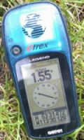
- Take a GEOCASHING GPS Unit
- Drink often to stay hydrated. Carry enough water for the day and your pack will get lighter as the day wears on.
- Make sure your footwear is suitable for the walk. Closed toe, supportive footwear with a good tread is recommended.
- Do not wear cotton clothing; instead wear clothing made of various synthetic materials.
- Pack some essentials; water, sunscreen, hat, bug spray, snacks and a trail guide map.
- Keep a small amount of surplus food ready, just in case.
- Know your own abilities and chose the right trail.
- Rest often for 5-7 minutes, and you'll reduce lactic acid buildup (sore muscles) drastically.
- Make sure someone knows where you are going. Call them when you get off the trail.
GEOCASHING
 GPS units are available, free of charge, with credit card deposit from
Quinte West
Chamber of Commerce
97 Front Street,
Trenton, Ontario
613-392-7635
Toll Free: 1-800-930-3255

EMERGENCY CALL 911
Trenton Memorial Hospital: 613-392-2540
Quinte Health Care Trenton Memorial Hospital
242 King Street
Trenton, ON K8V 5S6
Trenton Memorial Hospital Website


© Copyright 2001- All Rights Reserved


